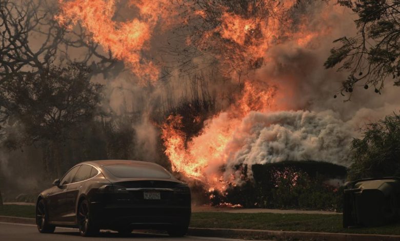
The dangerous combination fuelling the LA wildfires: Exceptional dryness and strong winds

Prolonged drought, an exceptionally dry winter and powerful Santa Ana winds set up a dangerous triple whammy of extreme conditions that have fuelled several out-of-control wildfires in the Los Angeles area.
Fast-moving fires have engulfed the Pacific Palisades neighbourhood, parts of Pasadena and Altadena, and Sylmar, north of San Fernando, with several deaths reported and more than 1,000 structures destroyed as of Wednesday.
Flames were fanned by ferocious winds whose gusts exceeded 100 mph in some places. The parched landscape across Southern California meant that any ignition was likely to become a monster blaze.
Know the news with the 7NEWS app: Download today
“We haven’t had any substantial rain for hundreds of days,” said Max Moritz, a wildfire specialist at the University of California, Santa Barbara.
With climate change altering rainfall patterns and making droughts both more likely and more intense, destructive wildfires like the ones in the Los Angeles area will continue to threaten people’s lives and livelihoods, Moritz said.
December to February is typically the rainy season in California, but unlike the northern part of the state, which has had its share of soakings, Southern California has been abnormally dry for the past eight months.
The last time Los Angeles logged more than one-tenth of an inch of rain was in early May.


That means the entire southern part of the state is in moderate to severe drought, according to the U.S. Drought Monitor.
Parts of San Diego County are experiencing their driest start to the winter season in more than 150 years, according to the Weather West blog by Daniel Swain, a climate scientist at UCLA.
The addition of the winds was like an “atmospheric blowdryer,” Swain wrote.
Combined, the conditions primed the region for destructive wildfires.
“Gusty winds and very dry conditions will continue to fuel fire starts and existing fires” through Friday, the Los Angeles office of the National Weather Service said Wednesday on X.
A resurgence in offshore wind is expected to keep fire risk high across the region through Friday morning, according to the National Oceanic and Atmospheric Administration’s Storm Prediction Center.
Santa Ana winds, which gain speed as they blow west and downslope from the Great Basin, are typical at this time of year. But conditions are not normally bone-dry when the winds gust through the mountains of Southern California toward the Pacific coast.


“Normally everything would be wet by now, which means there would be much less of a chance of an ignition leading to a big fire that gets out of control like what we’re seeing now,” Moritz said.
More than 15,000 acres have already burned in the Palisades Fire. The Eaton fire, which sparked Tuesday evening in the Pasadena and Altadena area, has engulfed over 10,000 acres. In Sylmar, the Hurst Fire has also grown to 500 acres, according to the California Department of Forestry and Fire Protection (Cal Fire).
Firefighting efforts have faced challenging conditions with ongoing high winds.
Such devastating blazes are expected to become more frequent as climate change amplifies the ingredients that help wildfires ignite and spread. Almost all of California’s largest wildfires have occurred in the last decade, according to Cal Fire.
Fires are typically fuelled by hot, dry and windy conditions. Moritz said there is not enough research yet to know whether climate change is altering winds in any significant way, but he said global warming is already having an impact on rainfall and drought.
“Climate change is leading to more erratic and extreme precipitation patterns,” he said. “That effect on precipitation is very important, because we’re having wetter wet periods and drier dry periods, and overall, we’re seeing this very erratic timing of precipitation.”
That means a region like Southern California could be hammered by severe flooding at one point, as it was in March, and then months later descend into drought. Lurching between those extremes puts people and their communities at heightened risk, Moritz said.
“That’s the climate signal in all of this — that we’ve opened this window where we can get these big, devastating extreme events now,” he said.


